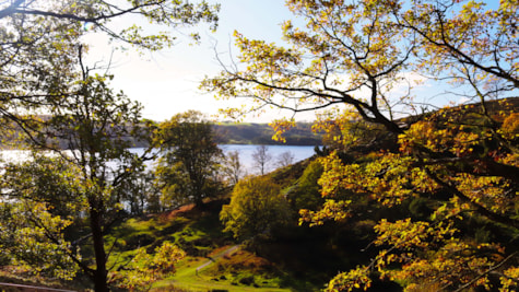
Dollerup Bakker lies on the edge of the ice margin line that separates the flat West Jutland from the hilly East Jutland, which was formed approx. 17.000 years ago during the last ice age. There are therefore large differences in height in the area. The area's highest point is 63 meters above sea level and from here there is a magnificent view over the southern and eastern part of Hald Sø.
Dollerup Bakker a nice excursion place and ideal for hiking in the hilly landscape. Dollerup Ishus is also located in the area, and there are good opportunities for parking in the car park on Ravnsbjergvej.
Find a map of Dollerup Bakker and Hald Sø here.
Follow in the footsteps of ...
Dollerup Hills is a great area to hike or bike in.
Maria, who has the blog Curlycamper.dk, has taken his girlfriend and dog on a hike in Dollerup Bakker. Read Maria's trip description here.
Line Wagener, who has the blog alleud.dk, has written a guide to four short hiking routes in the Dollerup Bakker and Hald Sø area. All trips can be completed in 1-2 hours. Read Line's guide here.
See what others are sharing on Instagram
#haldsø #visitviborg #aarhusregion
Updated by: VisitAarhus | info@visitaarhus.com
 Photographer: Janne Kragh Pedersen Copyright: Janne Kragh Pedersen
 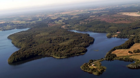 Photographer: VisitViborg Copyright: VisitViborg
 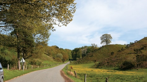 Photographer: VisitViborg Copyright: VisitViborg
 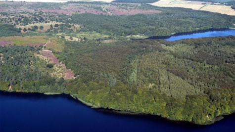 Photographer: VisitViborg Copyright: VisitViborg
 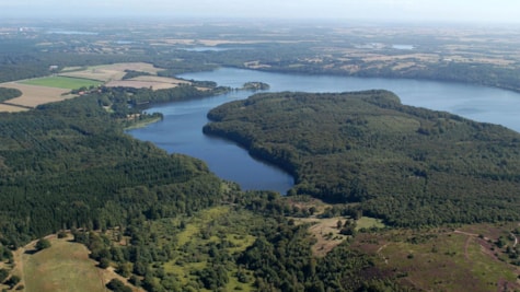 Photographer: VisitViborg Copyright: VisitViborg